If a picture says a thousand words, a map is a thousand pictures. And if the map is interactive – allowing you to zoom in and out, pan to different regions, and click on features to learn more about them – surely it would be over a million!
The Skeena Maps Portal (SMP) does just that: it allows users to view and query hundreds of spatial layers, as well as quickly make customized maps using an internet browser. This ease of access removes technological barriers involved in accessing spatial information such as land zoning, valued ecosystem mapping, and proposed project footprints without the hassle of downloads, specialized software, or a steep learning curve.
Check out some examples of how SMP maps are being used to inform and support land use decision-making processes!
Kalum Land & Resource Management Plan Map
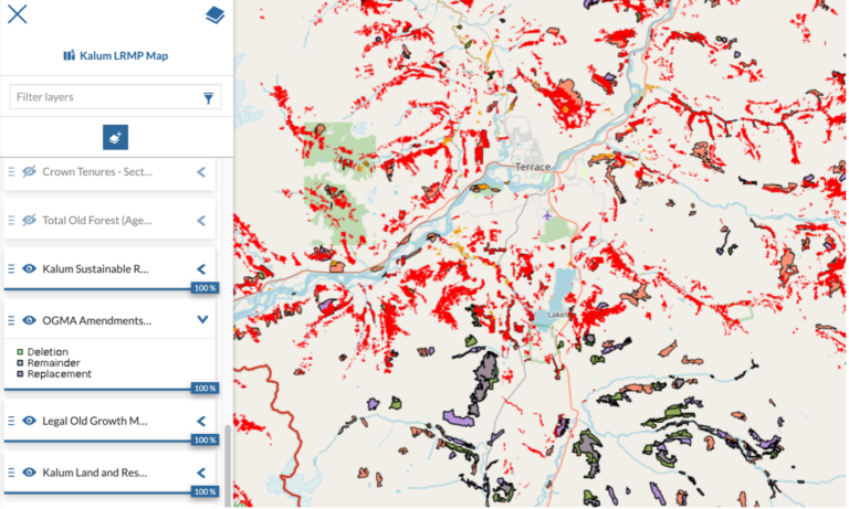
Screenshot of the Kalum LRMP Map showing the area around Terrace, BC.
The Kalum LRMP Map was prepared in partnership with the Kalum Land & Resource Management Plan Implementation Committee as a spatial planning and discussion tool. The original intent of the map was to provide valuable data and context for the KLRMP PIC to consult with the Province of BC on Old Growth Management Area co-location. However due to the flexible nature of the SMP, the map has been adapted to suit a variety of different planning and discussion needs relating to land, water and resource uses and cumulative impacts in northern BC!
Glaciers, Mining Interests, and Potential Salmon Habitat in Northwest BC
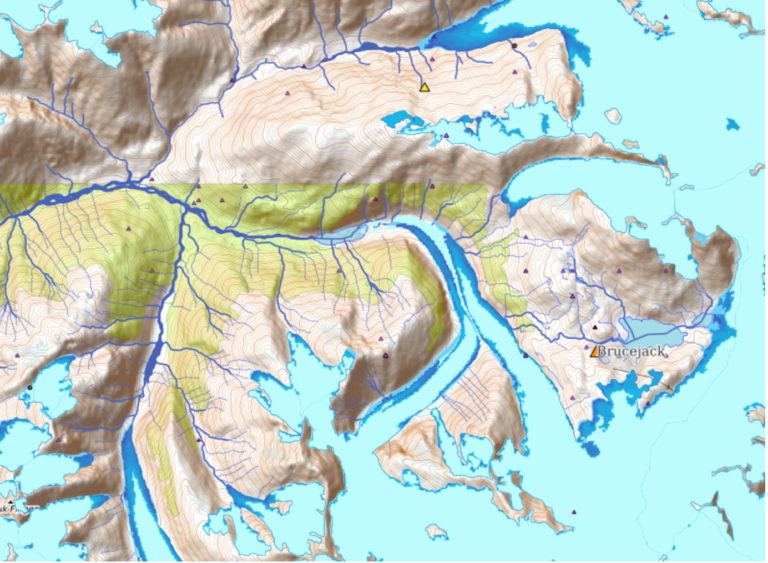
Screenshot of the Glaciers, Mining Interests, and Potential Salmon Habitat in Northwest BC map showing the area around
Brucejack gold mine near Stewart, BC.
The Glaciers, Mining Interests, and Potential Salmon Habitat in Northwest BC map was built in partnership with the Morice Water Monitoring Trust, Bulkley Valley Research Centre, Coast Mountain College, and Skeena Fisheries Commission. This map features multiple glacier extent layers for comparison of glacial retreat over the last four decades within the area of BC known colloquially as the “Golden Triangle” for its concentration of gold and copper mining interests. As glaciers retreat, new areas are uncovered, which could represent potential new salmon habitat as well as opportunities for increased mining exploration.
Watershed Stewardship Decision Support Tools
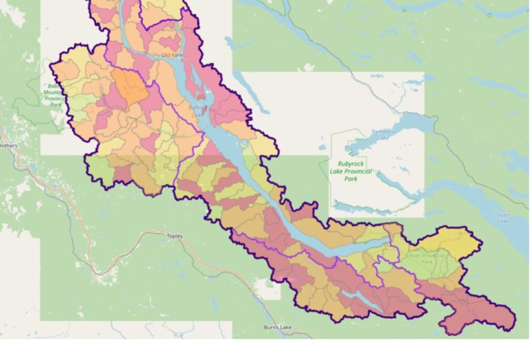
Screenshot from the Watershed Stewardship Decision Support Tool for Babine River and Babine Lake showing Equivalent
Clearcut Area (ECA) at multiple watershed levels.
The Watershed Stewardship Decision Support Tool for Babine River and Babine Lake and Kispiox River Watershed Stewardship Decision Support Tool were built in partnership with SkeenaWild Conservation Trust and Northern Habitat Solutions. These maps feature the results of ECA analysis with respect to Peak-Flow Sensitivity thresholds for risk characterization at multiple watershed levels within the respective watersheds. Users can query a specific location or sub-watershed and return ECA results for all the corresponding watershed levels at once and gain valuable insights into the spatial distribution and magnitude of watershed disturbances.
Old Growth Maps
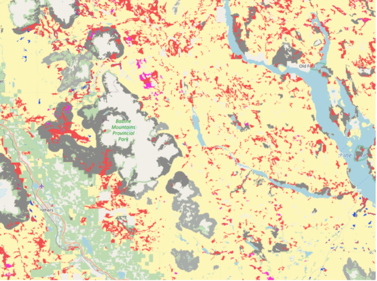
The Old Growth Maps on the Skeena Maps Portal are interactive versions of the maps produced by the BC Old Growth Technical Advisory Panel and were put together following the release of the datasets in response to requests from our stakeholders and significant public interest. These maps show priority recommendation areas for harvest deferral based on the methodology developed by the Advisory Panel, with options to zoom in on particular areas of interest, query values at particular locations, and combine the layers with other spatial information as is done in the Watershed Decision Support Tools described above.
Maps found on the Skeena Maps Portal include:
OGM Map 1: Priority Deferral Area
OGM Map 2: Big-Treed Old Growth
OGM Map 3: Prioritized Big-Treed Old Growth
OGM Map 4: Ancient Forests
OGM Map 5: Remnant Old Ecosystems
OGM Map 6: Intact Watersheds
OGM Map 7: Recruitment Forest
Old Growth Maps – All Layers
Next Steps
We are always open to exploring new initiatives and applications for the Skeena Maps Portal and Skeena Salmon Data Centre! Upcoming projects include the development of a restoration site registry and map in partnership with the Community Mapping Network and a stream temperature neural network visualization in partnership with the Skeena Fisheries Commission and Gitksan Watershed Authority.
Are you interested in partnering on a project or learning more about how you can use the Skeena Maps Portal for your work? Please contact us at info@skeenatrust.ca.
Acknowledgements
Thank you to Julia Hill and the Kalum LRMP PIC members, Len Vanderstar, Allison Oliver, Matt Beedle, Ian Sharpe, and Alexandre Bevington for providing feedback, support, and datasets!